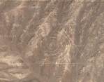
I got an email from Mike Scofield asking about this
odd thing that can be seen via Google's satellite map out in the middle of the desert around Nevada. Mike writes:
Assuming I did the link right, you should see a giant triangle with concentric circles in it. I did some poking around and it looks like this symbol is ~near~ Area 51. This leads me to think it's one of two different hoaxes. One is that it's a very good photoshop someone slipped into the satalite map that Google is referencing or, two, that it is a symbol out there in the desert someone did that isn't related to Area 51.
Honestly, I don't know what this is. I'm guessing it's some kind of military base. If you zoom in you can see that it hasn't been photoshopped in (at least, it doesn't appear to me as if it's been photoshopped). The triangle and concentric circles appear to be roads.


Comments
Much of the bombing range is accessible to the public and/or the media, though you usually need a guide (for your safety).
The big triangle is an old gravel air strip, with runways in three directions to facilitate unpowered landings in just about any wind.
The green circles are irrigated agriculture and are OUTSIDE of the bombing range. In Google, the area reserved for the test site is marked in gray, just like all government land or national parks.
These are not pranks or secret government installations. They're things you should expect to see on a bombing range/nuclear test site.
http://maps.google.com/maps?ll=37.666926,-116.027856&spn=0.015600,0.021286&t=k&hl=en
<a >CLICK!</a>
<a > this should work</a>
Google it if you're interested.
http://maps.google.ca/maps?q=groom+lake&ll=37.401409,-116.867967&sll=34.710938,-112.109525&spn=0.004849,0.007467&sspn=3.851563,7.259440&t=k&hl=en
and this
http://maps.google.ca/maps?q=groom+lake&ll=37.401409,-116.867967&sll=34.710938,-112.109525&spn=0.004849,0.007467&sspn=3.851563,7.259440&t=k&hl=en
There's photos from the "neighbourhood".